Quick answer
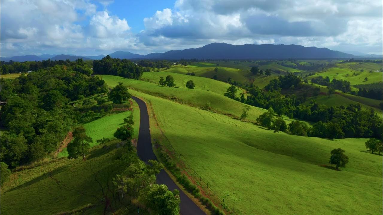
The Atherton Tablelands lie 90 kilometres southwest of Cairns, reachable by car in around 90 minutes via the Gillies Highway or Kennedy Highway. Self-drive remains the most flexible option, though several coach operators run full-day tours that include waterfall stops and crater-lake visits. The Gillies route climbs through rainforest with frequent lookout points; the Kennedy route runs faster but bypasses the scenic switchbacks.
The Gillies Highway carries most leisure traffic because it threads through Wooroonooran National Park before cresting the escarpment at Yungaburra. The 55-kilometre stretch from Gordonvale climbs through closed-canopy rainforest, with pull-offs at Mamu Tropical Skywalk and Curtain Fig Tree adding an hour to the journey if you stop. Morning departures from Cairns avoid afternoon fog that occasionally settles over the range, reducing visibility on the tighter bends. Public transport to the Tablelands remains limited. No scheduled bus service links Cairns directly to Atherton township, so travellers without a vehicle typically book guided tours that bundle transport with waterfall visits and wildlife spotting. These coach trips depart Cairns between 07:00 and 08:00, returning by early evening after circuits through Millaa Millaa, Lake Eacham and Malanda. The Kennedy Highway offers a faster alternative for drivers prioritising arrival speed over scenery. The route follows the Captain Cook Highway north before turning inland at Smithfield, bypassing the Gillies switchbacks entirely. Drive time drops to 75 minutes, though you forfeit rainforest canopy views and the string of waterfalls that make the Gillies climb worthwhile for first-time visitors. Fuel and supplies are available in Atherton township, where the visitor information centre at 1A Herberton Road provides regional maps and waterfall track updates. The centre opens daily from 09:00 to 16:00, with staff able to confirm current road conditions after heavy rain. Volcanic soil and high rainfall keep the plateau green year-round, but wet-season downpours between December and March occasionally close unsealed tracks to crater lakes and swimming holes. Reaching the Atherton Tablelands from Cairns requires either a rental vehicle or a pre-booked tour; rideshare services do not operate on the route, and hitchhiking remains uncommon along the inland highways.
“Morning departures from Cairns avoid afternoon fog that occasionally settles over the range, reducing visibility on the tighter bends.”
How To Get To Atherton Tablelands From Cairns: Transport Modes
The Atherton Tablelands are located southwest of Cairns, accessible via several well-maintained mountain ranges. Driving is the most common method for exploring the region's diverse terrain and townships.
Gillies Range Road (State Route 52) via Gordonvale
Kuranda Range Road (State Route 81) via Smithfield
Trans North Bus & Coach from Cairns City
Planning Your Day Trip: How To Get To Atherton Tablelands From Cairns
This timeline suits travellers leaving Cairns early and returning by evening, allocating roughly 90 minutes each way for the journey and five hours in the tablelands. The schedule assumes a private vehicle or tour departure around 07:30.
Depart Cairns
Leave the city before peak traffic to reach the tablelands by 09:00, allowing time to stop at viewpoints along the Gillies or Kuranda Range routes.
Arrive and Orient
Stop at the Atherton Visitor Information Centre (1A Herberton Road) to collect maps, confirm road conditions, and finalise your route through Yungaburra, Millaa Millaa, or Lake Tinaroo.
Explore Waterfalls and Villages
Visit accessible waterfalls like Millaa Millaa Falls, then browse cafés and galleries in Yungaburra or Atherton; budget 20–30 minutes per waterfall including short walks.
Lunch Break
Eat at a local pub, bakery, or farm gate venue in Atherton, Malanda, or Yungaburra; many close by 15:00 so arrive before the kitchen winds down.
Crater Lakes or Wildlife
Drive to Lake Eacham or Lake Barrine for a rainforest boardwalk (30–45 minutes), or visit Granite Gorge to hand-feed rock wallabies before starting your return.
Begin Return Journey
Leave the tablelands by 16:00 to reach Cairns before dark, accounting for winding descent roads and potential wildlife on the roadside at dusk.
Visitor Information Centre Hours For How To Get To Atherton Tablelands From Cairns
The Atherton Visitor Information Centre is open daily to assist with planning your travel from Cairns to the Atherton Tablelands.
| Monday | 09:00–16:00 | |
|---|---|---|
| Tuesday | 09:00–16:00 | |
| Wednesday | 09:00–16:00 | |
| Thursday | 09:00–16:00 | |
| Friday | 09:00–16:00 | |
| Saturday | 09:00–16:00 | |
| Sunday | 09:00–16:00 |
Best Time To Travel: How To Get To Atherton Tablelands From Cairns
The period between April and October offers the most stable conditions for navigating the mountain roads between Cairns and the Atherton Tablelands. Planning your departure to coincide with daylight hours ensures safer driving conditions and clearer visibility.
April–October
ModerateMild, 15°C–25°C. Dry season with lower humidity.
Ideal for comfortable exploration and reliable road conditions.
November–March
LowWarm and humid, 20°C–30°C. Wet season influences travel.
High rainfall can affect road safety; check local alerts frequently.
Weekday Mornings
Low—
Arriving between 09:00–15:30 provides the optimal window to seek local guidance at the visitor centre.
Verdict: For the safest travel and clearest weather, visit during the dry season months of April to October, arriving at the visitor centre within the optimal window of 09:00–15:30.
Nearby Attractions While Figuring Out How To Get To Atherton Tablelands From Cairns
As you travel from Cairns into the Atherton Tablelands, several sites align with the natural progression of the route. These locations provide natural and historical context before you conclude your journey at the visitor information centre.
Barron Falls
Located along the scenic drive, this site offers views of the gorge and river systems typical of the Tablelands transition. It serves as a natural stop to experience the rainforest landscape early in your route.
Lake Barrine
This volcanic crater lake is situated directly on the route from the coast. It provides a quiet environment for observing local birdlife and flora before reaching the main township.
Crystal Caves
Located within Atherton, this attraction complements a visit to the information centre by displaying geological specimens found in the region. It allows for a deeper understanding of the area's physical history after you have gathered your travel materials.
Check availability
Frequently asked questions about visiting the Atherton Tablelands
Everything you need to know about how to get to atherton tablelands from cairns