
Quick answer
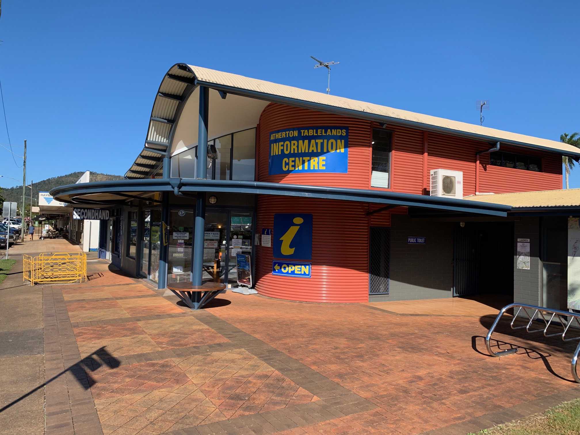
The Atherton Tablelands tourist map is available free at the Atherton Visitor Information Centre, corner of Herberton Road and Silo Road, open daily 09:00–16:00. The centre distributes printed regional touring maps showing waterfall circuits, heritage rail trails, and crater lake access roads. Arrive between 09:00 and 15:00 to allow time for route consultation with staff before starting your drive.
The Atherton Tablelands sits 600 to 900 metres above sea level, a corrugated landscape of extinct volcanic cones, dairy pasture, and wet tropics remnants stretched across an area larger than Belgium. Most visitors drive circuits linking Curtain Fig Tree, Lake Eacham, Millaa Millaa Falls, and the heritage railway stations, but the plateau holds 47 gazetted waterfalls, 18 crater lakes, and countless farm gates marked only by hand-painted signs. Without detailed cartography, you miss the unmarked turnoffs to swimming holes and the gravel tracks that shortcut between townships. The Atherton visitor centre at the junction of Herberton Road and Silo Road functions as the region's cartographic hub. Staff distribute free printed maps covering the entire tablelands, with waterfall circuits, scenic drives, and farm-gate producers marked in detail. The centre also stocks touring guides for the Tablelands Rail Trail, the Cathedral Fig boardwalk, and the volcanic crater rim walks around Lake Barrine and Lake Eacham. Digital versions of the core touring map appear on the Tablelands Regional Council website, but the printed edition carried by the centre includes updated road condition notes and seasonal access warnings for wet season closures. The plateau's road network mixes sealed highways with unsealed forestry tracks and private farm roads open to respectful visitors. Mobile coverage drops to zero outside the five main townships, and fuel stations close after 17:00 in most villages. The visitor centre map marks the fuel stops, the mobile black zones, and the roads that become impassable mud channels during the December-to-March wet season. Staff provide verbal route notes for multi-day loops and flag the lookouts that require four-wheel-drive clearance. Collecting your atherton tablelands tourist map before departure turns improvised wandering into structured exploration, with contingency fuel stops and mobile coverage windows plotted in advance.
“The plateau holds 47 gazetted waterfalls and 18 crater lakes, most reached only by unmarked farm tracks and forestry turnoffs.”
Finding Your Way: Atherton Tablelands Tourist Map and Visitor Access
The Atherton Tablelands are best explored via a self-drive itinerary, with the visitor information centre serving as the primary hub for physical map collection. It is located at the Corner of Herberton Road and Silo Road, Atherton, QLD 4883, Australia.
Gillies Range Road (State Route 52) from Cairns
Kennedy Highway (State Route 25) from Cairns
Trans North Bus Service to Atherton
Visitor Information Centre Hours for Your Atherton Tablelands Tourist Map
The Atherton Visitor Information Centre is open daily to assist you with acquiring your Atherton Tablelands tourist map. These consistent hours provide ample opportunity for you to plan your self-drive itinerary throughout the week.
| Monday | 09:00–16:00 | |
|---|---|---|
| Tuesday | 09:00–16:00 | |
| Wednesday | 09:00–16:00 | |
| Thursday | 09:00–16:00 | |
| Friday | 09:00–16:00 | |
| Saturday | 09:00–16:00 | |
| Sunday | 09:00–16:00 |
Costs and Fees: Atherton Tablelands Tourist Map Availability
Access to the visitor information centre and the collection of standard tourist maps are provided at no cost. There are no entrance fees required to obtain local touring information.
A typical adult pays 0 AUD to enter the centre, with no additional fees for standard maps.
Best Time to Arrive and Plan Your Atherton Tablelands Tourist Map Route
The best arrival window for map collection and itinerary planning is 09:00–15:00. Arriving early provides sufficient time to orient yourself and gather local insights before heading out on your self-drive journey.
Weekday mornings
Lower visitor volume—
Quieter periods allow for more focused map consultation.
Dry season (May–October)
Moderate crowdsMild temperatures (15°C–25°C)
Lower humidity makes this the most comfortable time for outdoor exploration.
Wet season (November–April)
Higher visitor numbers during school breaksWarm with periodic rain (20°C–30°C)
Expect lush landscapes but check weather forecasts for regional road accessibility.
Verdict: The optimal time to visit is during the dry season from May to October, arriving between 09:00 and 11:00 on a weekday to secure your maps and plan your route.
Regional Highlights to Explore Using Your Atherton Tablelands Tourist Map
Once you have collected your tourist map and planned your route at the visitor centre, several significant natural and historical landmarks are easily accessible by car. These locations allow you to contextualize the geography and heritage of the Atherton Tablelands.
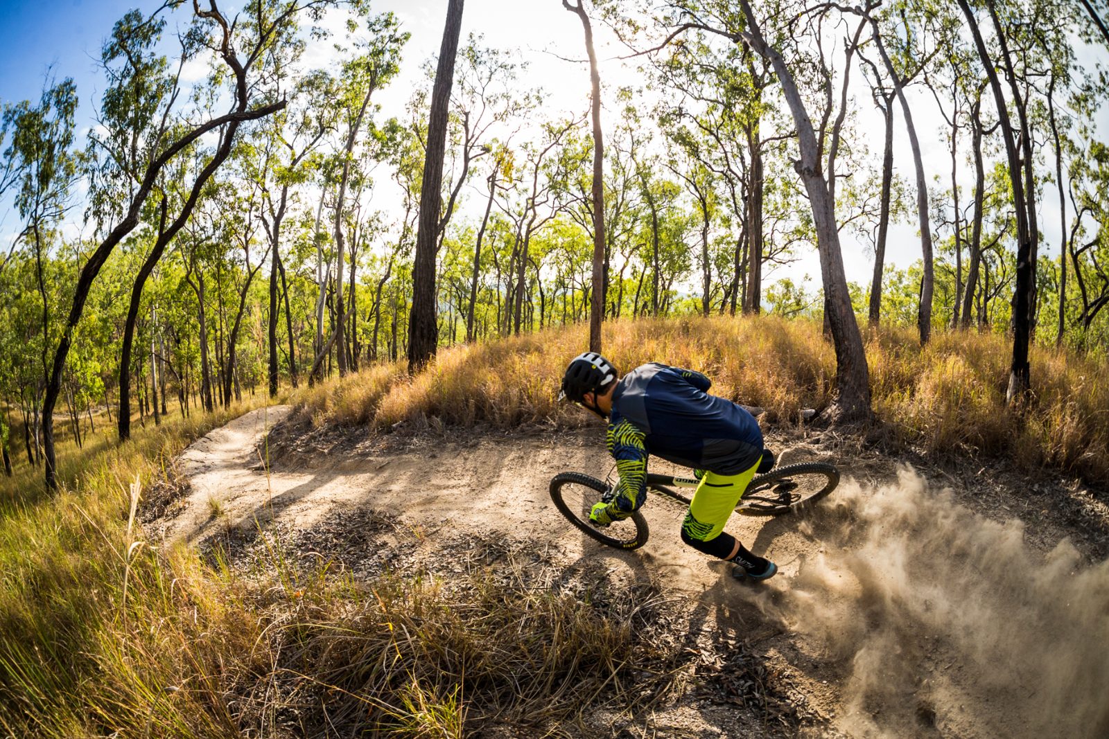
Atherton Forest Mountain Bike Park
Located near the visitor centre, this area offers trails that highlight the region's diverse forest landscapes.
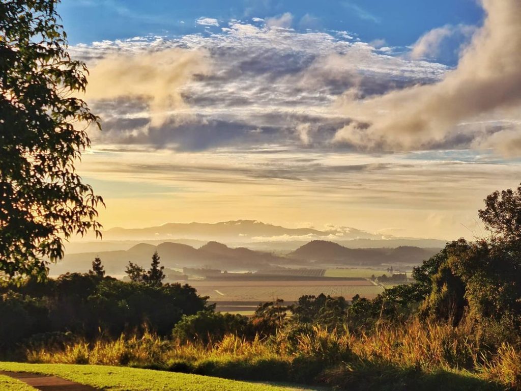
Hallorans Hill Conservation Park
This site provides panoramic views over the town and surrounding volcanic landscape, serving as a helpful orientation point.
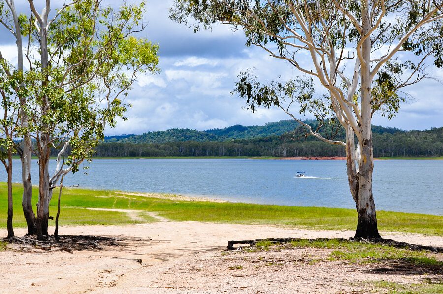
Lake Tinaroo
This large reservoir is a central feature for water-based activities and provides a clear landmark for those heading toward the eastern tablelands.
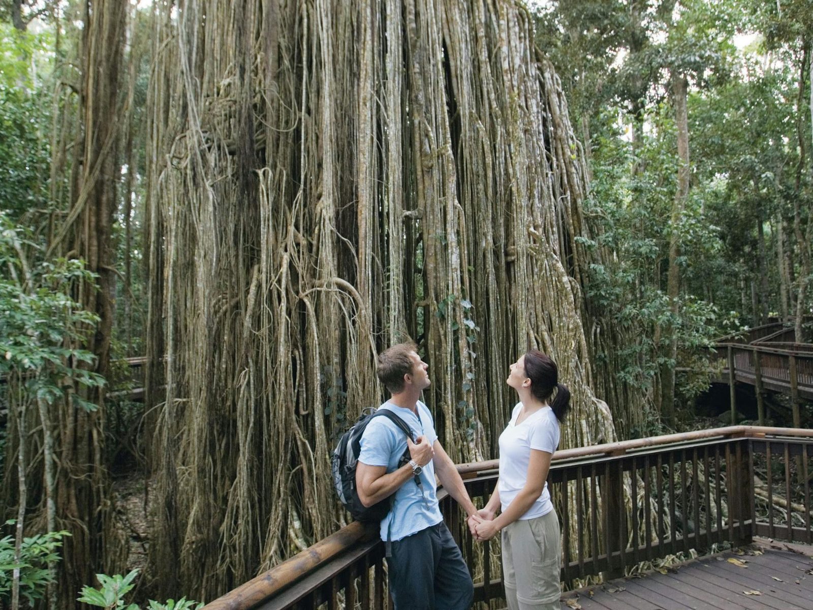
Curtain Fig Tree
A notable natural landmark on the tourist map, this large tree demonstrates the unique botanical characteristics of the local rainforest.
Atherton Tablelands Tourist Map Pre-Visit Preparation Checklist
Prepare for a self-drive tour across volcanic plateaus, crater lakes, and rainforest pockets with these essential steps.
-
Collect a physical map at the visitor centre — Digital coverage can be patchy in rural highland areas, and printed maps show alternate routes.
-
Download offline GPS maps before departure — Mobile signal drops between towns, and many waterfalls and lookouts sit off main roads.
-
Pack a cooler and refillable water bottles — Distances between towns are significant, and picnic spots outnumber cafés in remote corners.
-
Check fuel levels in Atherton or Malanda — Service stations thin out quickly, and some scenic loops add 50–80 km to your route.
-
Wear sun protection and closed walking shoes — Crater rim walks and waterfall trails involve exposed sections and uneven volcanic rock.
-
Confirm seasonal road conditions for 4WD tracks — Wet season closures affect access to Mount Hypipamee and some western plateau roads.
Check availability
Frequently Asked Questions About Atherton Tablelands Tourist Map
Everything you need to know about atherton tablelands tourist map